Датотека:Blank Map World Secondary Political Divisions.svg

Veličina PNG pregleda za ovu SVG datoteku je 512 × 260 piksela. 5 drugih rezolucija: 320 × 163 piksela | 640 × 325 piksela | 1.024 × 520 piksela | 1.280 × 650 piksela | 2.560 × 1.300 piksela.
Originalna datoteka (SVG datoteka, nominalno 512 × 260 piksela, veličina: 2,42 MB)
| Ovo je datoteka sa Vikimedijine ostave. Informacije sa njene stranice sa opisom prikazane su ispod. Vikimedijina ostava je skladište slobodno licenciralnih multimedijalnih datoteka. I Vi možete da pomognete. |
Opis izmene
| Opis |
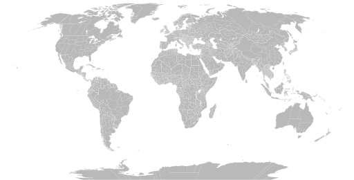
English: A detailed Robinson projection SVG map of the world with secondary political units grouped for easy coloring. |
| Datum | |
| Izvor | |
| Autor |
|
Licenciranje
Ja, nosilac autorskog prava nad ovim delom, objavljujem isto pod sledećom licencom:
| Ova datoteka je dostupna pod licencom Creative Commons 1.0 Univerzalna – posvećivanje javnom vlasništvu. | |
| Osoba koja je učestvovalo u radu na ovom dokumentu posvetila je delo javnom vlasništvu, odričući se svih prava na to delo širom sveta, po zakonu o autorskim pravima i povezanim ili srodnim zakonskim pravima koje bi imao/imala, u meri dozvoljenoj zakonom. Možete da umnožavate, menjate, raspodeljujete i prilagođavate delo, čak i u komercijalne svrhe, bez traženja dozvole.
|
Istorija datoteke
Kliknite na datum/vreme da biste videli tadašnju verziju datoteke.
| Datum/vreme | Minijatura | Dimenzije | Korisnik | Komentar | |
|---|---|---|---|---|---|
| trenutna | 08:50, 10. jun 2024. | | 512 × 260 (2,42 MB) | ClaveScottPH | Fixed |
| 06:01, 10. jun 2024. |  | 3.413 × 1.752 (5,9 MB) | ClaveScottPH | {{subst:update-note|1=File:Blank Map World Secondary Political Divisions.svg|2=new cantons in Luxembourg, municipalities in Latvia, new regions in Chile, Tanzania, the Philippines, Mali, Kazakhstan, Ghana, and Ethiopia, new prefectures in the Central African Republic, new provinces in Equatorial Guinea, Burundi, Algeria, Laos, Indonesia, Nepal, and the Democratic Republic of the Congo, new governorates in Lebanon and Oman, new administrative area in South Sudan have been created.}} ~~~~ | |
| 21:10, 28. maj 2022. |  | 2.560 × 1.314 (4,59 MB) | Betseg | Reverted to version as of 00:32, 13 March 2022 (UTC). Nearly double the size because of the high detailed divisions, and the colours were broken. | |
| 23:47, 7. maj 2022. |  | 2.560 × 1.314 (7,27 MB) | Abbasi786786 | Made Pakistan and Nigeria more precise; Added new Congolese provinces | |
| 02:32, 13. mart 2022. |  | 2.560 × 1.314 (4,59 MB) | Abbasi786786 | Merged KPK and former FATA, Pakistan | |
| 13:20, 13. decembar 2021. |  | 2.560 × 1.314 (4,59 MB) | W0nderhat | Reverted to version as of 18:26, 6 June 2020 (UTC); removal of Chilean Patagonia unnecessary and confusing, ISO codes an unfortunate casualty (will look into how to restore them) | |
| 22:39, 20. septembar 2020. |  | 2.560 × 1.314 (4,27 MB) | Hoehermann | Added or adjusted ISO-3166 codes for Mexico, Morocco, USA, Antarctica, Cuba, Greenland. Separated Antarctica from Chile. Removed comments. | |
| 20:26, 6. jun 2020. |  | 2.560 × 1.314 (4,59 MB) | Raphaël Dunant | Update India | |
| 20:27, 2. jul 2019. |  | 2.560 × 1.314 (4,58 MB) | AHC300 | 1 | |
| 20:04, 2. jul 2019. |  | 2.560 × 1.314 (4,58 MB) | AHC300 | Fixed some errors in map |
Upotreba datoteke
Sledeća stranica koristi ovu datoteku:
Globalna upotreba datoteke
Drugi vikiji koji koriste ovu datoteku:
- Upotreba na bn.wikipedia.org
- Upotreba na bs.wikipedia.org
- Upotreba na en.wikipedia.org
- Government
- Administrative division
- Wikipedia:Blank maps
- Wikipedia:Graphics Lab/Map workshop/Archive/May 2011
- User:Naqsh-e hJahan/List of provinces
- User talk:Naqsh-e hJahan/List of provinces
- Wikipedia:Graphics Lab/Illustration workshop/Archive/Jun 2023
- Wikipedia:Graphics Lab/Map workshop/Archive/Jul 2023
- Upotreba na ja.wikipedia.org
- Upotreba na ne.wikipedia.org
- Upotreba na sq.wikipedia.org
- Upotreba na te.wikipedia.org
- Upotreba na tr.wikipedia.org
- Upotreba na zh.wikipedia.org