Датотека:Coram-ny-map.png
Veća rezolucija nije dostupna.
Coram-ny-map.png (575 × 425 piksela, veličina datoteke: 45 kB, MIME tip: image/png)
| Ovo je datoteka sa Vikimedijine ostave. Informacije sa njene stranice sa opisom prikazane su ispod. Vikimedijina ostava je skladište slobodno licenciralnih multimedijalnih datoteka. I Vi možete da pomognete. |
Opis izmene

|
This file was moved to Wikimedia Commons from en.wikipedia using a bot script. All source information is still present. It requires review. Additionally, there may be errors in any or all of the information fields; information on this file should not be considered reliable and the file should not be used until it has been reviewed and any needed corrections have been made. Once the review has been completed, this template should be removed. For details about this file, see below. Check now! |
| Opis | |
| Datum | |
| Izvor | http://factfinder.census.gov |
| Autor | United States Census Bureau |
| Dozvola (Ponovno korišćenje ove datoteke) |
Public domain |
Licenciranje
This image or file is a work of a United States Census Bureau employee, taken or made as part of that person's official duties. As a work of the U.S. federal government, the image is in the public domain.
|
 |
Prvobitan dnevnik otpremanja
Transferred from en.wikipedia to Commons by Milicevic01 using CommonsHelper.
The original description page was here. All following user names refer to en.wikipedia.
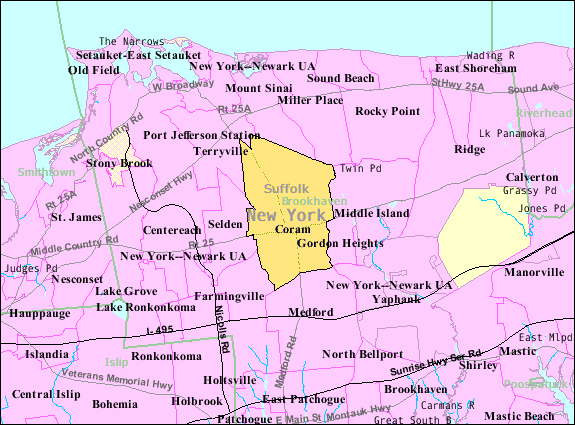
- 2007-11-25 00:58 Americasroof 575×425× (49046 bytes) [[Coram, New York]] map from U.S. Census
Prvobitan dnevnik otpremanja
| Datum/vreme | Dimenzije | Korisnik | Komentar |
|---|---|---|---|
| 22. avgust 2013., 16:47:58 | 575 × 425 (49046 bytes) | File Upload Bot (Magnus Manske) (razgovor · doprinosi) | Transfered from en.wikipedia by [[User:Milicevic01]] using CommonsHelper |
Istorija datoteke
Kliknite na datum/vreme da biste videli tadašnju verziju datoteke.
| Datum/vreme | Minijatura | Dimenzije | Korisnik | Komentar | |
|---|---|---|---|---|---|
| trenutna | 09:12, 3. decembar 2014. | | 575 × 425 (45 kB) | GifTagger | Bot: Converting file to superior PNG file. (Source: Coram-ny-map.gif). This GIF was problematic due to non-greyscale color table. |
Upotreba datoteke
Sledeća stranica koristi ovu datoteku:
Globalna upotreba datoteke
Drugi vikiji koji koriste ovu datoteku:
- Upotreba na ar.wikipedia.org
- Upotreba na arz.wikipedia.org
- Upotreba na azb.wikipedia.org
- Upotreba na ca.wikipedia.org
- Upotreba na ceb.wikipedia.org
- Upotreba na en.wikipedia.org
- Upotreba na es.wikipedia.org
- Upotreba na eu.wikipedia.org
- Upotreba na fa.wikipedia.org
- Upotreba na fr.wikipedia.org
- Upotreba na sh.wikipedia.org
- Upotreba na tt.wikipedia.org
- Upotreba na vo.wikipedia.org
- Upotreba na www.wikidata.org