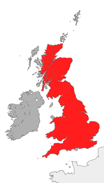
Датотека:Great Britain.svg

Veličina PNG pregleda za ovu SVG datoteku je 343 × 600 piksela. 6 drugih rezolucija: 137 × 240 piksela | 274 × 480 piksela | 439 × 768 piksela | 586 × 1.024 piksela | 1.171 × 2.048 piksela | 675 × 1.180 piksela.
Originalna datoteka (SVG datoteka, nominalno 675 × 1.180 piksela, veličina: 135 kB)
Istorija datoteke
Kliknite na datum/vreme da biste videli tadašnju verziju datoteke.
| Datum/vreme | Minijatura | Dimenzije | Korisnik | Komentar | |
|---|---|---|---|---|---|
| trenutna | 13:49, 29. april 2021. |  | 675 × 1.180 (135 kB) | GPinkerton | Reverted to version as of 09:41, 22 May 2009 (UTC) Great Britain is the island 99% of the time, so leaving out the other islands (i.e. islands that are not Great Britain) makes most sense. Reverting to version used for 10+ years |
| 00:01, 2. januar 2021. |  | 675 × 1.180 (136 kB) | Bbx118 | Reverted to version as of 01:37, 21 October 2007 (UTC) | |
| 00:01, 2. januar 2021. |  | 675 × 1.180 (136 kB) | Bbx118 | Reverted to version as of 01:29, 21 October 2007 (UTC) | |
| 00:00, 2. januar 2021. |  | 675 × 1.180 (136 kB) | Bbx118 | Reverted to version as of 01:37, 21 October 2007 (UTC) | |
| 11:41, 22. maj 2009. |  | 675 × 1.180 (135 kB) | Mehmet Karatay | Great Britain is the name of the largest island, not all the English, Scottish and Welsh islands. Changed colouring to reflect this. | |
| 03:37, 21. oktobar 2007. |  | 675 × 1.180 (136 kB) | Cnbrb | == Summary == {{Information |Description=map showing the island of Great Britain in the context of Great Britain and Ireland |Source=self-made |Date=2007-21-09 |Author= Cnbrb }} Category:Locator maps of countries of the United Kingdom | |
| 03:29, 21. oktobar 2007. |  | 675 × 1.180 (136 kB) | Cnbrb | == Summary == {{Information |Description=map showing the island of Great Britain in the context of Great Britain and Ireland |Source=self-made |Date=2007-21-09 |Author= Cnbrb }} Category:Locator maps of countries of the United Kingdom | |
| 03:26, 21. oktobar 2007. |  | 675 × 1.180 (303 kB) | Cnbrb | == Summary == {{Information |Description=map showing the island of Great Britain in the context of Great Britain and Ireland |Source=self-made |Date=2007-21-09 |Author= Cnbrb }} Category:Locator maps of countries of the United Kingdom |
Upotreba datoteke
3 sledeće stranice koriste ovu datoteku:
Globalna upotreba datoteke
Drugi vikiji koji koriste ovu datoteku:
- Upotreba na af.wikipedia.org
- Upotreba na als.wikipedia.org
- Upotreba na ba.wikipedia.org
- Upotreba na cs.wikipedia.org
- Upotreba na de.wikipedia.org
- Upotreba na en.wikipedia.org
- Upotreba na eo.wikipedia.org
- Upotreba na es.wikipedia.org
- Upotreba na fr.wikipedia.org
- Upotreba na fr.wikinews.org
- Upotreba na hr.wiktionary.org
- Upotreba na hu.wikipedia.org
- Upotreba na ia.wikipedia.org
- Upotreba na id.wikipedia.org
- Upotreba na it.wikipedia.org
- Upotreba na ku.wikipedia.org
- Upotreba na ro.wikipedia.org
- Upotreba na ru.wikipedia.org
- Upotreba na sc.wikipedia.org
- Upotreba na simple.wikipedia.org
- Upotreba na simple.wiktionary.org
- Upotreba na tr.wikipedia.org
- Upotreba na uk.wikipedia.org
- Upotreba na vi.wikipedia.org
- Upotreba na www.wikidata.org
- Upotreba na zh.wikipedia.org