Датотека:Location map of AegeanIslands (Greece).svg

Veličina PNG pregleda za ovu SVG datoteku je 693 × 599 piksela. 6 drugih rezolucija: 278 × 240 piksela | 555 × 480 piksela | 888 × 768 piksela | 1.184 × 1.024 piksela | 2.369 × 2.048 piksela | 8.460 × 7.315 piksela.
Originalna datoteka (SVG datoteka, nominalno 8.460 × 7.315 piksela, veličina: 1,87 MB)
| Ovo je datoteka sa Vikimedijine ostave. Informacije sa njene stranice sa opisom prikazane su ispod. Vikimedijina ostava je skladište slobodno licenciralnih multimedijalnih datoteka. I Vi možete da pomognete. |
.svg)
Opis izmene
| Opis |
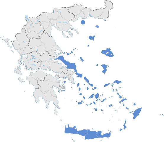
English: The location of Greek Aegean Islands within Greece. |
| Datum | |
| Izvor | Sopstveno delo |
| Autor | SilentResident,Philly boy92 |
Licenciranje
Ja, nosilac autorskog prava nad ovim delom, objavljujem isto pod sledećom licencom:
Ova datoteka je dostupna pod licencom Creative Commons Autorstvo-Deliti pod istim uslovima 3.0 Unported.
- Dozvoljeno je:
- da delite – da umnožavate, raspodeljujete i prenosite delo
- da prerađujete – da preradite delo
- Pod sledećim uslovima:
- autorstvo – Morate da date odgovarajuće zasluge, obezbedite vezu ka licenci i naznačite da li su izmene napravljene. Možete to uraditi na bilo koji razuman manir, ali ne na način koji predlaže da licencator odobrava vas ili vaše korišćenje.
- deliti pod istim uslovima – Ako izmenite, preobrazite ili dogradite ovaj materijal, morate podeliti svoje doprinose pod istom ili kompatibilnom licencom kao original.
Istorija datoteke
Kliknite na datum/vreme da biste videli tadašnju verziju datoteke.
| Datum/vreme | Minijatura | Dimenzije | Korisnik | Komentar | |
|---|---|---|---|---|---|
| trenutna | 08:10, 18. jul 2021. | | 8.460 × 7.315 (1,87 MB) | SilentResident | Correcting Euboea and Crete, which for some strange reason I missed marking them as Aegean Islands even though they are. |
| 05:22, 21. avgust 2018. |  | 8.460 × 7.315 (1,83 MB) | SilentResident | Reverted to version as of 17:09, 17 January 2015 (UTC) The islands are part of geographical Aegean Sea nevertheless. | |
| 13:28, 25. mart 2016. |  | 8.460 × 7.315 (1,37 MB) | Nikospag | Thasos and Sporades are not part of Aegean Islands region | |
| 19:09, 17. januar 2015. |  | 8.460 × 7.315 (1,83 MB) | SilentResident | {{Information |Description ={{en|1=The location of Greek Aegean Islands within Greece.}} |Source ={{own}} |Author =SilentResident,Philly boy92 |Date =2014-01-17 |Permission... |
Upotreba datoteke
Sledeća stranica koristi ovu datoteku:
Globalna upotreba datoteke
Drugi vikiji koji koriste ovu datoteku:
- Upotreba na ar.wikipedia.org
- Upotreba na el.wikipedia.org
- Upotreba na en.wikipedia.org
- Upotreba na eu.wikipedia.org
- Upotreba na fi.wikipedia.org
- Upotreba na fr.wikipedia.org
- Upotreba na hyw.wikipedia.org
- Upotreba na ml.wikipedia.org
- Upotreba na ta.wikipedia.org
- Upotreba na th.wikipedia.org
- Upotreba na www.wikidata.org
.svg)