Датотека:Keyesport Illinois with Carlyle Lake filling.jpg
Величина овог приказа: 800 × 533 пиксела. 4 друге резолуције: 320 × 213 пиксела | 640 × 427 пиксела | 1.024 × 683 пиксела | 1.500 × 1.000 пиксела.
Оригинална датотека (1.500 × 1.000 пиксела, величина датотеке: 287 kB, MIME тип: image/jpeg)
| Ово је датотека са Викимедијине оставе. Информације са њене странице са описом приказане су испод. Викимедијина остава је складиште слободно лиценциралних мултимедијалних датотека. И Ви можете да помогнете. |
| Опис |
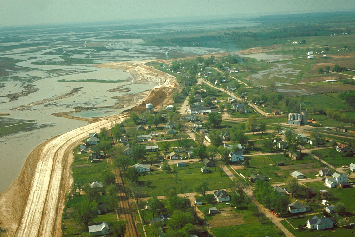
English: Aerial view of Keyesport, Illinois, USA. The photograph was taken in 1967 or 1968 after the Carlyle Lake Dam had been completed and Carlyle Lake was filling. The town now lies directly on the lakeshore. |
|||
| Датум | circa 1968 | |||
| Извор |
U.S. Army Corps of Engineers Digital Visual Library Image page Image description page Digital Visual Library home page |
|||
| Аутор | U.S. Army Corps of Engineers, photographer not specified or unknown | |||
| Дозвола (Поновно коришћење ове датотеке) |
|
|||
| Локација | Keyesport, Illinois, USA |
| Положај камере | | Ова и друге слике снимљене у близини на: OpenStreetMap |
|---|
Историја датотеке
Кликните на датум/време да бисте видели тадашњу верзију датотеке.
| Датум/време | Минијатура | Димензије | Корисник | Коментар | |
|---|---|---|---|---|---|
| тренутна | 23:01, 7. април 2007. | | 1.500 × 1.000 (287 kB) | DanMS | {{Information | Description = {{en|Aerial view of Keyesport, Illinois, USA. The photograph was taken in 1967 or 1968 after the Carlyle Lake Dam had been completed and Carlyle Lake was filling. The town now lies directly on the lakeshore.}} | So |
Употреба датотеке
Следећа страница користи ову датотеку:
Глобална употреба датотеке
Други викији који користе ову датотеку:
- Употреба на ar.wikipedia.org
- Употреба на ca.wikipedia.org
- Употреба на ceb.wikipedia.org
- Употреба на cy.wikipedia.org
- Употреба на en.wikipedia.org
- Употреба на es.wikipedia.org
- Употреба на eu.wikipedia.org
- Употреба на fr.wikipedia.org
- Употреба на ht.wikipedia.org
- Употреба на it.wikipedia.org
- Употреба на lld.wikipedia.org
- Употреба на pl.wikipedia.org
- Употреба на pt.wikipedia.org
- Употреба на uk.wikipedia.org
- Употреба на vi.wikipedia.org
- Употреба на www.wikidata.org
- Употреба на zh-min-nan.wikipedia.org
- Употреба на zh.wikipedia.org