Датотека:Caribbean Sea Gulf of Mexico shaded relief bathymetry land map.png
Оригинална датотека (1.024 × 664 пиксела, величина датотеке: 1,1 MB, MIME тип: image/png)
| Ово је датотека са Викимедијине оставе. Информације са њене странице са описом приказане су испод. Викимедијина остава је складиште слободно лиценциралних мултимедијалних датотека. И Ви можете да помогнете. |
Опис измене
| Опис |
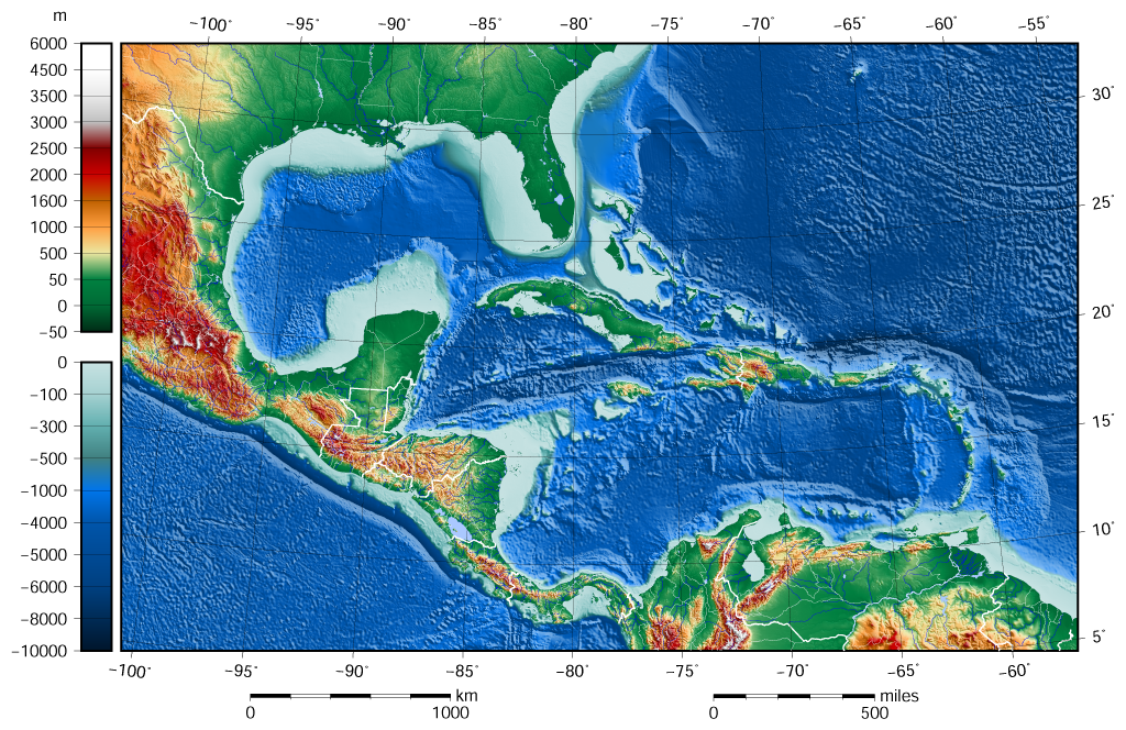
English: The shaded relief bathymetry and land map of the Caribbean Sea and Gulf of Mexico area. The map was created using the Generic Mapping Tools, GMT, version 5.1.1. |
| Датум | |
| Извор |
Own work using: the following Public Domain datasets for the relief:
|
| Аутор | Darekk2 using the ETOPO1 and GLOBE tiles |
| Остале верзије |
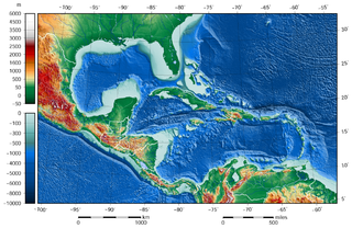
The same image but contoured at -100 m: |

Лиценцирање
Attribution (in addition to the author of this map):
The NGDC in it's copyright notice says:
As required by 17 U.S.C. 403, third parties producing copyrighted works consisting predominantly of the material produced by U.S. government agencies must provide notice with such work(s) identifying the U.S. Government material incorporated and stating that such material is not subject to copyright protection within the United States. (...)
(for credits see the Source section).
and GLOBE and ETOPO1
(see above and the Source section)
- Дозвољено је:
- да делите – да умножавате, расподељујете и преносите дело
- да прерађујете – да прерадите дело
- Под следећим условима:
- ауторство – Морате да дате одговарајуће заслуге, обезбедите везу ка лиценци и назначите да ли су измене направљене. Можете то урадити на било који разуман манир, али не на начин који предлаже да лиценцатор одобрава вас или ваше коришћење.
- делити под истим условима – Ако измените, преобразите или доградите овај материјал, морате поделити своје доприносе под истом или компатибилном лиценцом као оригинал.
Историја датотеке
Кликните на датум/време да бисте видели тадашњу верзију датотеке.
| Датум/време | Минијатура | Димензије | Корисник | Коментар | |
|---|---|---|---|---|---|
| тренутна | 11:58, 8. јун 2015. | | 1.024 × 664 (1,1 MB) | Darekk2 | added lakes ... and changed palette for land (white highest mountains) |
| 17:23, 12. мај 2015. |  | 1.024 × 664 (1,09 MB) | Darekk2 | changed the illumination azimuth from 100 to 45 deg. | |
| 17:59, 21. март 2015. |  | 1.024 × 664 (1,11 MB) | Darekk2 | a little wider in the east | |
| 17:07, 21. март 2015. |  | 1.024 × 664 (1,11 MB) | Darekk2 | changed parallels of the projection, removed black borderline | |
| 17:05, 19. март 2015. |  | 1.024 × 684 (1,15 MB) | Darekk2 | shortened elevation and depth legends | |
| 20:25, 18. март 2015. |  | 1.024 × 684 (1,15 MB) | Darekk2 | User created page with UploadWizard |
Употреба датотеке
Следећа страница користи ову датотеку:
Глобална употреба датотеке
Други викији који користе ову датотеку:
- Употреба на ar.wikipedia.org
- Употреба на avk.wikipedia.org
- Употреба на en.wikipedia.org
- Употреба на gl.wikipedia.org
- Употреба на hr.wikipedia.org
- Употреба на sd.wikipedia.org
- Употреба на vep.wikipedia.org