Датотека:Txu-oclc-10552568-nh50-14.jpg
Величина овог приказа: 796 × 600 пиксела. 6 других резолуција: 319 × 240 пиксела | 637 × 480 пиксела | 1.020 × 768 пиксела | 1.280 × 964 пиксела | 2.560 × 1.929 пиксела | 5.000 × 3.767 пиксела.
Оригинална датотека (5.000 × 3.767 пиксела, величина датотеке: 5,55 MB, MIME тип: image/jpeg)
| Ово је датотека са Викимедијине оставе. Информације са њене странице са описом приказане су испод. Викимедијина остава је складиште слободно лиценциралних мултимедијалних датотека. И Ви можете да помогнете. |
Опис
| Опис |
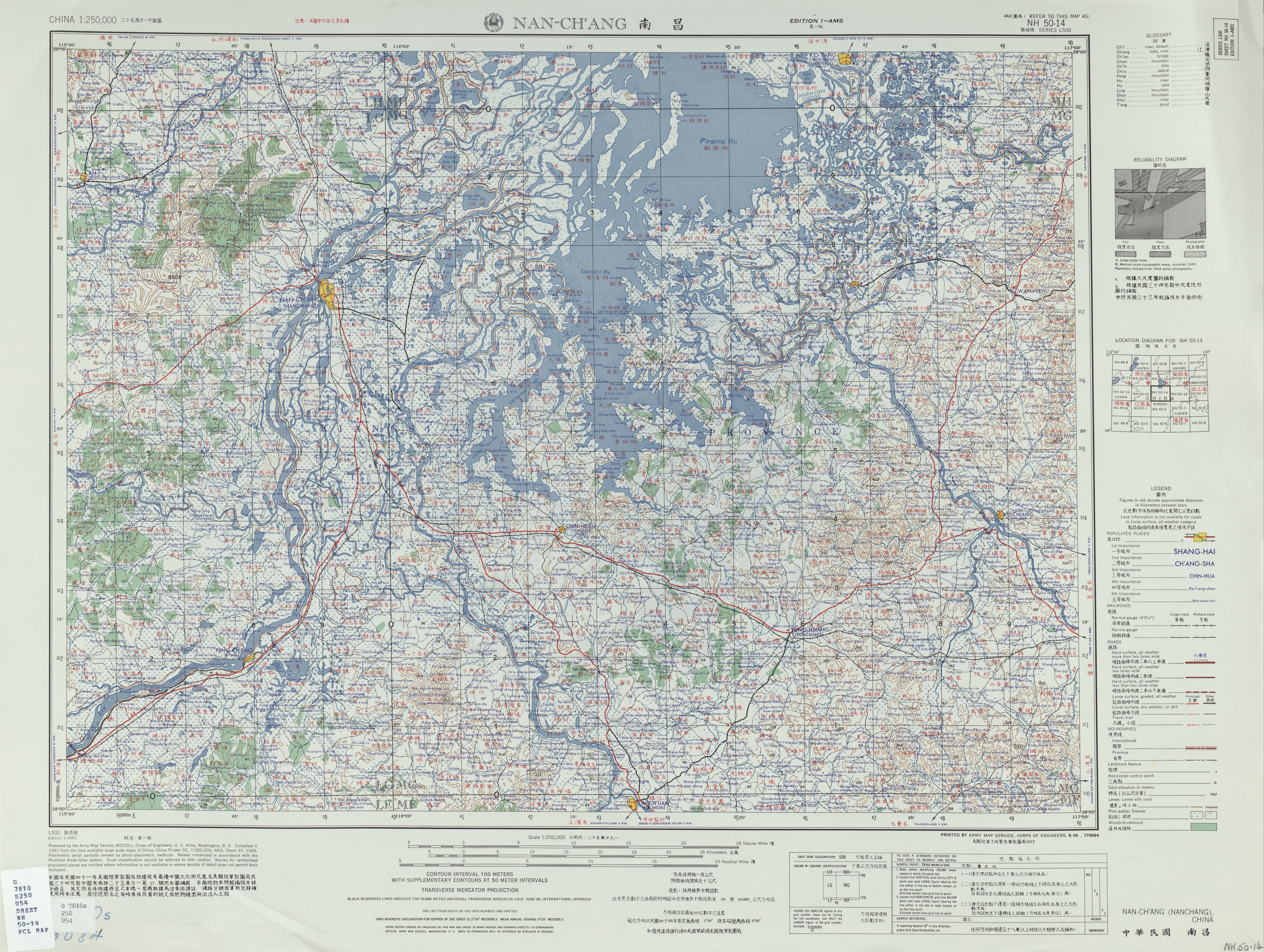
English: Map of Nanchang (Nan-ch'ang) and surrounding region, in the China AMS Topographic Maps series |
| Датум | |
| Извор | Courtesy of the University of Texas Libraries, The University of Texas at Austin. ([1]) |
| Аутор | Army Map Service (NSCOL), Corps of Engineers, 1952 |
| Остале верзије |
|

![[1]](http://legacy.lib.utexas.edu/maps/ams/china/txu-oclc-10552568-nh50-14.jpg)
Лиценцирање
This image or file is a work of a U.S. Army Corps of Engineers soldier or employee, taken or made as part of that person's official duties. As a work of the U.S. federal government, the image is in the public domain.
|
Историја датотеке
Кликните на датум/време да бисте видели тадашњу верзију датотеке.
| Датум/време | Минијатура | Димензије | Корисник | Коментар | |
|---|---|---|---|---|---|
| тренутна | 00:30, 1. мај 2020. | | 5.000 × 3.767 (5,55 MB) | Geographyinitiative | Uploaded a work by Army Map Service (NSCOL), Corps of Engineers, 1952 from Courtesy of the [http://legacy.lib.utexas.edu/maps/ams/china/ University of Texas Libraries, The University of Texas at Austin]. ([http://legacy.lib.utexas.edu/maps/ams/china/txu-oclc-10552568-nh50-14.jpg]) with UploadWizard |
Употреба датотеке
Следећа страница користи ову датотеку:
Глобална употреба датотеке
Други викији који користе ову датотеку:
- Употреба на bg.wikipedia.org
- Употреба на bn.wikipedia.org
- Употреба на en.wikipedia.org
- Употреба на uz.wikipedia.org