Датотека:Leland Michigan aerial view.jpg

Veličina ovog prikaza: 800 × 562 piksela. 5 drugih rezolucija: 320 × 225 piksela | 640 × 449 piksela | 1.024 × 719 piksela | 1.280 × 899 piksela | 1.500 × 1.053 piksela.
Originalna datoteka (1.500 × 1.053 piksela, veličina datoteke: 626 kB, MIME tip: image/jpeg)
| Ovo je datoteka sa Vikimedijine ostave. Informacije sa njene stranice sa opisom prikazane su ispod. Vikimedijina ostava je skladište slobodno licenciralnih multimedijalnih datoteka. I Vi možete da pomognete. |
| Opis |
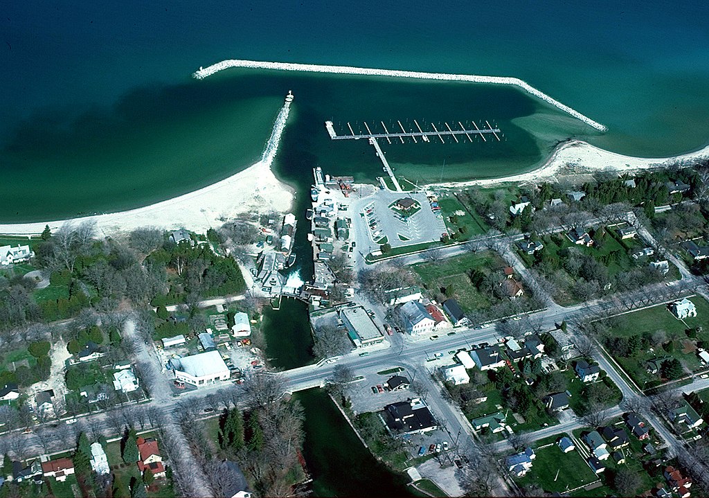
English: Aerial view of the shore and breakwater on Lake Michigan at Leland, Michigan, USA. The U.S. Army Corps of Engineers constructed the harbor and breakwater at the town. |
|||
| Datum | not specified or unknown | |||
| Izvor |
U.S. Army Corps of Engineers Digital Visual Library Image page Image description page Digital Visual Library home page |
|||
| Autor | U.S. Army Corps of Engineers, photographer not specified or unknown | |||
| Dozvola (Ponovno korišćenje ove datoteke) |
|
|||
| Lokacija | Leland, Leelanau County, Michigan, USA |
| Положај камере | | Ова и друге слике снимљене у близини на: OpenStreetMap |
|---|
Istorija datoteke
Kliknite na datum/vreme da biste videli tadašnju verziju datoteke.
| Datum/vreme | Minijatura | Dimenzije | Korisnik | Komentar | |
|---|---|---|---|---|---|
| trenutna | 01:58, 30. mart 2007. | | 1.500 × 1.053 (626 kB) | DanMS | {{Information | Description = {{en|Aerial view of the shore and breakwater on Lake Michigan at Leland, Michigan, USA. The U.S. Army Corps of Engineers constructed the harbor and breakwater at the town.}} | Source = U.S. Army Corps of Engineers |
Upotreba datoteke
Sledeća stranica koristi ovu datoteku:
Globalna upotreba datoteke
Drugi vikiji koji koriste ovu datoteku:
- Upotreba na azb.wikipedia.org
- Upotreba na ceb.wikipedia.org
- Upotreba na cy.wikipedia.org
- Upotreba na en.wikipedia.org
- Upotreba na en.wikivoyage.org
- Upotreba na es.wikipedia.org
- Upotreba na fa.wikipedia.org
- Upotreba na fr.wikipedia.org
- Upotreba na lld.wikipedia.org
- Upotreba na pl.wikipedia.org
- Upotreba na ro.wikipedia.org
- Upotreba na sh.wikipedia.org
- Upotreba na sv.wikipedia.org
- Upotreba na tt.wikipedia.org
- Upotreba na uk.wikipedia.org
- Upotreba na www.wikidata.org