Датотека:Persia 1814.jpg
Veličina ovog prikaza: 718 × 600 piksela. 6 drugih rezolucija: 287 × 240 piksela | 575 × 480 piksela | 920 × 768 piksela | 1.226 × 1.024 piksela | 2.452 × 2.048 piksela | 2.931 × 2.448 piksela.
Originalna datoteka (2.931 × 2.448 piksela, veličina datoteke: 1,6 MB, MIME tip: image/jpeg)
| Ovo je datoteka sa Vikimedijine ostave. Informacije sa njene stranice sa opisom prikazane su ispod. Vikimedijina ostava je skladište slobodno licenciralnih multimedijalnih datoteka. I Vi možete da pomognete. |
Opis izmene
| Opis |
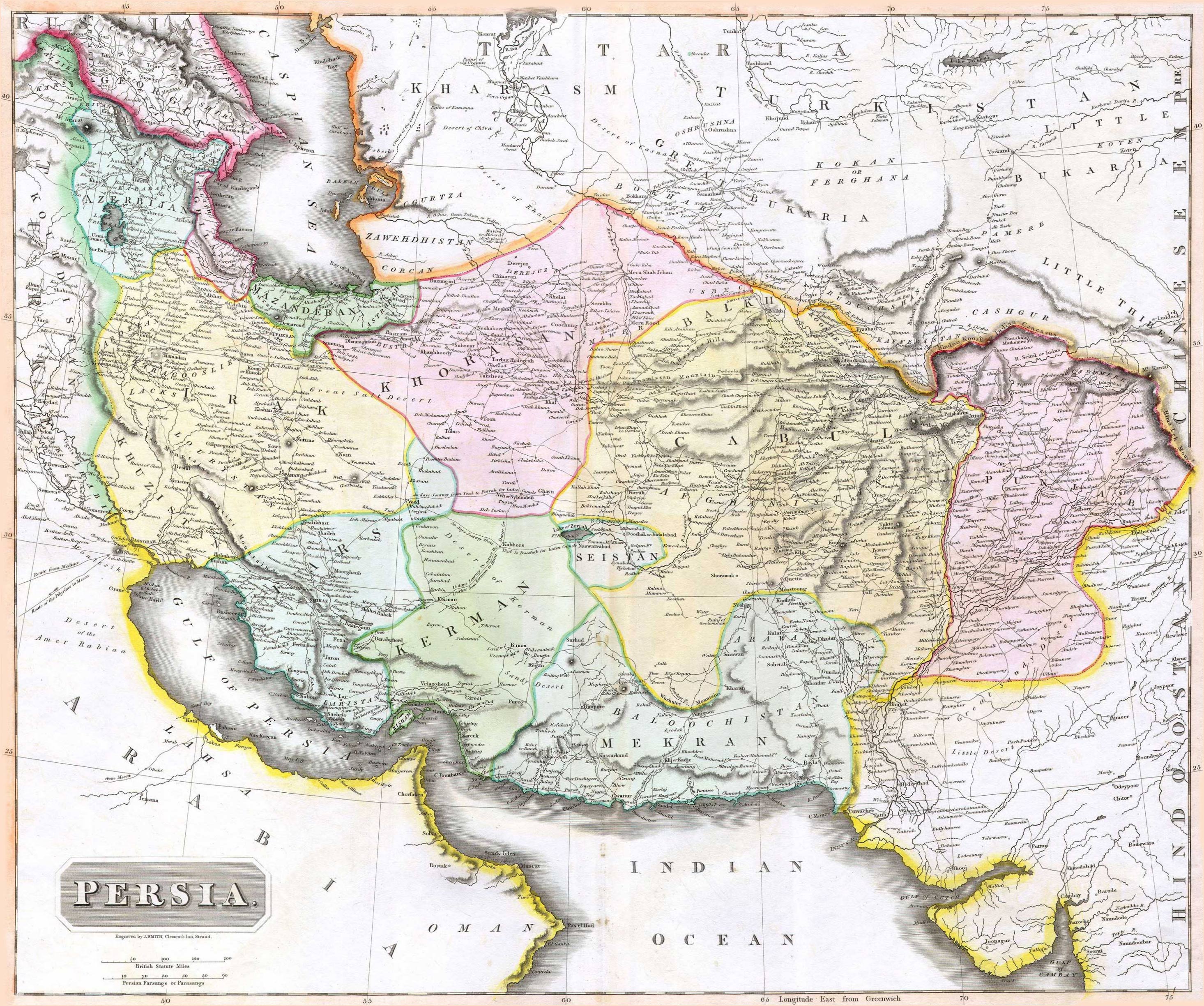
English: 1814 Thomson Map of Persia (Iran), engraved by J. Smith, Clement's Inn, Strand. |
| Datum | |
| Tvorac |
J. Smith, Clement's Inn, Strand. |
| Geotemporal data | |
| Map location | Iran |
| Georeferencing | If inappropriate please set warp_status = skip to hide. |
| Bibliographic data | |
| Publikacija |
New General Atlas (1821) |
| Autor |
John Thomson |
| Ostale verzije | |

Licenciranje
The copyright situation of this work is theoretically uncertain, because in the country of origin copyright lasts 70 years after the death of the author, and the date of the author's death is unknown. However, the date of creation of the work was over 120 years ago, and it is thus a reasonable assumption that the copyright has expired (see here for the community discussion). Do not use this template if the date of death of the author is known.
Овај рад је у јавном власништву у Сједињеним Државама зато што је објављен или регистрован у канцеларији за ауторска права САД-а пре 1. јануара 1929. | |
| Utvrđeno je da ova datoteka nije ograničena u pogledu autorskih prava, uključujući i sva srodna i susedna prava. | |
Istorija datoteke
Kliknite na datum/vreme da biste videli tadašnju verziju datoteke.
| Datum/vreme | Minijatura | Dimenzije | Korisnik | Komentar | |
|---|---|---|---|---|---|
| trenutna | 09:27, 18. avgust 2010. | | 2.931 × 2.448 (1,6 MB) | Begoon | edge perspective and crop |
| 04:35, 19. novembar 2006. |  | 2.979 × 2.520 (1,45 MB) | Kaveh | == Summary == 1814 Thomson Map of Persia (Iran) Category:Maps of Iran == Licensing == {{PD-old}} |
Upotreba datoteke
2 sledeće stranice koriste ovu datoteku:
Globalna upotreba datoteke
Drugi vikiji koji koriste ovu datoteku:
- Upotreba na ar.wikipedia.org
- Upotreba na az.wikipedia.org
- Upotreba na be.wikipedia.org
- Upotreba na bn.wikipedia.org
- Upotreba na bs.wikipedia.org
- Upotreba na ca.wikipedia.org
- Upotreba na da.wikipedia.org
- Upotreba na de.wikipedia.org
- Upotreba na en.wikipedia.org
- Upotreba na es.wikipedia.org
- Upotreba na eu.wikipedia.org
- Upotreba na fa.wikipedia.org
- Upotreba na fr.wikipedia.org
- Upotreba na hi.wikipedia.org
- Upotreba na hr.wikipedia.org
Još globalnog korišćenja ove datoteke.