Датотека:Plan, Red River and Assiniboine in 1836 (1863).jpg

Originalna datoteka (4.200 × 5.136 piksela, veličina datoteke: 3,97 MB, MIME tip: image/jpeg)
| Ovo je datoteka sa Vikimedijine ostave. Informacije sa njene stranice sa opisom prikazane su ispod. Vikimedijina ostava je skladište slobodno licenciralnih multimedijalnih datoteka. I Vi možete da pomognete. |
Opis izmene
| Opis |
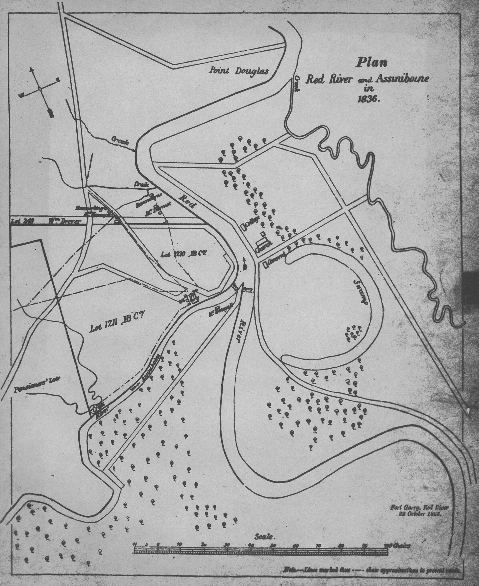
Anonymous. Plan, Red River and Assiniboine in 1836 [map]. 1:7,200. 1863. The copy the scan was made from is blurry. There is a manuscript map, ink on paper with property lines and roads coloured in the Provincial Archives of Manitoba. The provenance of this map is uncertain. Ostensibly it is a plan of Red River Settlement in 1836, with, however, further features added in 1863, particularly houses and locations of ferrys. The double lines appear to be property boundaries, and in some instances they also mark the locations of roads. The solid lines, for example those connecting the A.G.B Bannatyne home with Fort Garry, are roads which were in existence in 1863 when the map was presumably copied. Of greatest significance are the relationships of the three main components of Red River Settlement, shown as they were in 1863: (i) Fort Garry, (ii) the new centre, where George (Dutch George) Emmerling and Henry McKenney had their stores, and Bannatyne and Andrew McDermot their homes, and (iii) the French community across the river. The swamp in St. Boniface, presently drained and occupied by Enfield Crescent, is an oxbow of the Red River. (Warkentin and Ruggles. Historical Atlas of Manitoba. map 76, p. 190) Image Courtesy of University of Manitoba Archives & Special Collections |
|||
| Datum | ||||
| Izvor | Plan, Red River and Assiniboine in 1836 (1863) | |||
| Autor | Anonymous via Wyman Laliberte from Edmonton, Canada | |||
| Dozvola (Ponovno korišćenje ove datoteke) |
|

.jpg)
Licenciranje
- Dozvoljeno je:
- da delite – da umnožavate, raspodeljujete i prenosite delo
- da prerađujete – da preradite delo
- Pod sledećim uslovima:
- autorstvo – Morate da date odgovarajuće zasluge, obezbedite vezu ka licenci i naznačite da li su izmene napravljene. Možete to uraditi na bilo koji razuman manir, ali ne na način koji predlaže da licencator odobrava vas ili vaše korišćenje.
| This image was originally posted to Flickr by Manitoba Historical Maps at https://www.flickr.com/photos/11496488@N07/3253318777. It was reviewed on 21. april 2013. by FlickreviewR and was confirmed to be licensed under the terms of the cc-by-2.0. |
Istorija datoteke
Kliknite na datum/vreme da biste videli tadašnju verziju datoteke.
| Datum/vreme | Minijatura | Dimenzije | Korisnik | Komentar | |
|---|---|---|---|---|---|
| trenutna | 03:41, 21. april 2013. | | 4.200 × 5.136 (3,97 MB) | Geo Swan | {{Information |Description=Anonymous. Plan, Red River and Assiniboine in 1836 [map]. 1:7,200. 1863. The copy the scan was made from is blurry. There is a manuscript map, ink on paper with property lines and roads coloured in the Provincial Archives of... |
Upotreba datoteke
3 sledeće stranice koriste ovu datoteku:
.jpg)