Датотека:Spring Lake Bridge.jpg
Veličina ovog prikaza: 771 × 599 piksela. 6 drugih rezolucija: 309 × 240 piksela | 617 × 480 piksela | 988 × 768 piksela | 1.280 × 995 piksela | 2.560 × 1.990 piksela | 4.778 × 3.715 piksela.
Originalna datoteka (4.778 × 3.715 piksela, veličina datoteke: 2,1 MB, MIME tip: image/jpeg)
| Ovo je datoteka sa Vikimedijine ostave. Informacije sa njene stranice sa opisom prikazane su ispod. Vikimedijina ostava je skladište slobodno licenciralnih multimedijalnih datoteka. I Vi možete da pomognete. |
|
This is an image of a place or building that is listed on the National Register of Historic Places in the United States of America. Its reference number is 90000510. |
| Положај камере | | Ова и друге слике снимљене у близини на: OpenStreetMap |
|---|
| Opis |
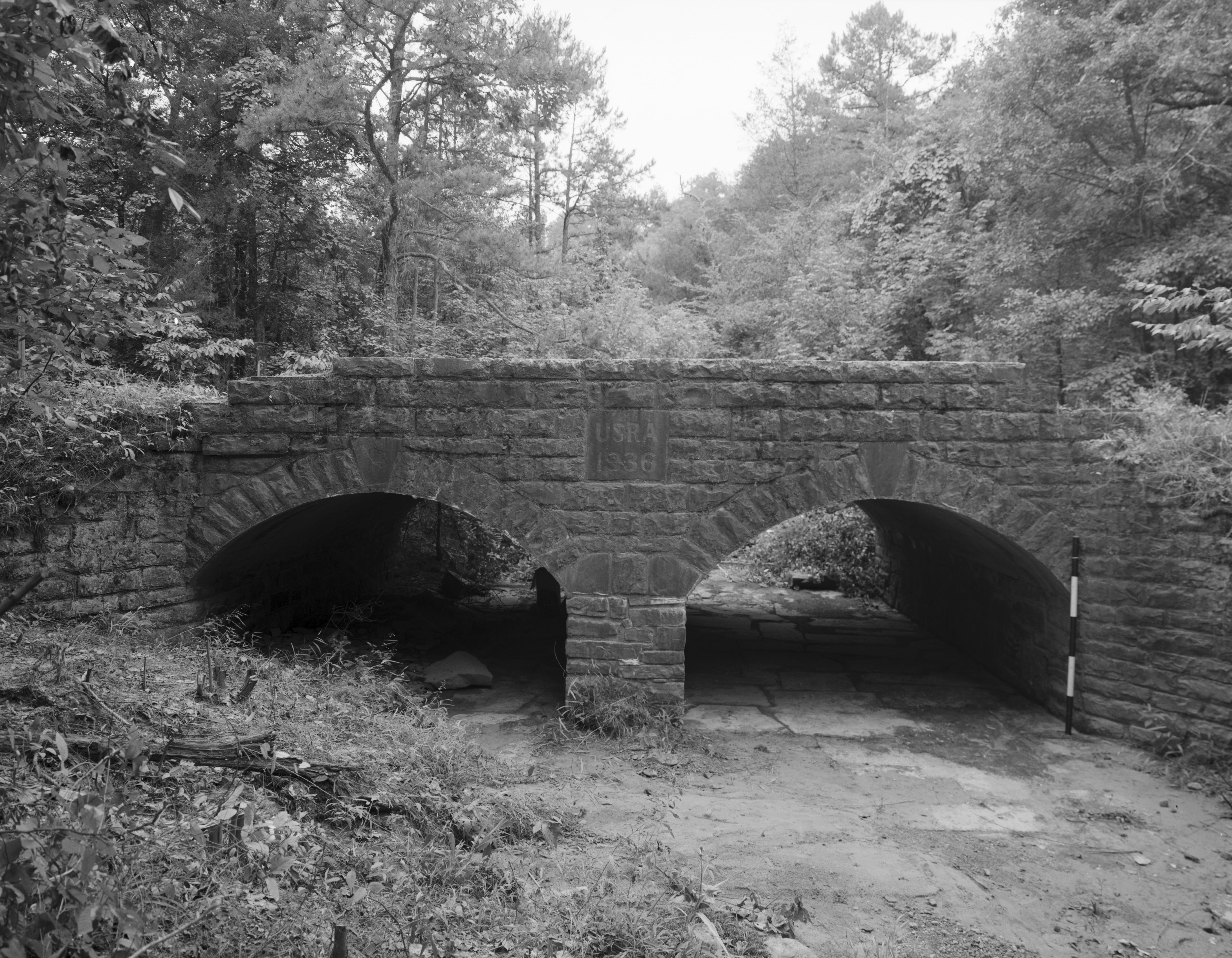
English: Eastern side of the Spring Lake Bridge, which carries Highway 307 over the Bob Barnes Branch near Belleville in Yell County, Arkansas, United States. Built in 1936, this closed spandrel stone deck arch bridge is listed on the National Register of Historic Places. |
||||
| Datum | |||||
| Izvor | Library of Congress, Prints and Photograph Division HAER: ARK,75-BELVI.V,1-1 | ||||
| Autor | Jeff Holder | ||||
| Dozvola (Ponovno korišćenje ove datoteke) |
|

|
This image is available from the United States Library of Congress's Prints and Photographs division
under the digital ID hhh.ar0094. This tag does not indicate the copyright status of the attached work. A normal copyright tag is still required. See Commons:Licensing.
|
Istorija datoteke
Kliknite na datum/vreme da biste videli tadašnju verziju datoteke.
| Datum/vreme | Minijatura | Dimenzije | Korisnik | Komentar | |
|---|---|---|---|---|---|
| trenutna | 02:55, 13. decembar 2009. | | 4.778 × 3.715 (2,1 MB) | Nyttend | {{Location|35|9|4|N|93|25|54|W}} {{Information |Description={{en|Eastern side of the {{w|Spring Lake Bridge}}, which carries {{w|Arkansas Highway 307|Highway 307}} over the Bob Barnes Branch near {{w|Belleville, Arkansas|Belleville}} in {{w|Yell County, A |
| 02:52, 13. decembar 2009. |  | 4.760 × 4.622 (2,37 MB) | Nyttend | {{Location|35|9|4|N|93|25|54|W}} {{Information |Description={{en|Eastern side of the {{w|Spring Lake Bridge}}, which carries {{w|Arkansas Highway 307|Highway 307}} over the Bob Barnes Branch near {{w|Belleville, Arkansas|Belleville}} in {{w|Yell County, A |
Upotreba datoteke
Sledeća stranica koristi ovu datoteku:
Globalna upotreba datoteke
Drugi vikiji koji koriste ovu datoteku:
- Upotreba na en.wikipedia.org
- Upotreba na fr.wikipedia.org
- Upotreba na www.wikidata.org