Датотека:Territory of the Republic of Ragusa early 18th century.png
Veličina ovog prikaza: 769 × 600 piksela. 4 druge rezolucije: 308 × 240 piksela | 616 × 480 piksela | 985 × 768 piksela | 1.241 × 968 piksela.
Originalna datoteka (1.241 × 968 piksela, veličina datoteke: 2,56 MB, MIME tip: image/png)
| Ovo je datoteka sa Vikimedijine ostave. Informacije sa njene stranice sa opisom prikazane su ispod. Vikimedijina ostava je skladište slobodno licenciralnih multimedijalnih datoteka. I Vi možete da pomognete. |
Opis izmene
| Opis |
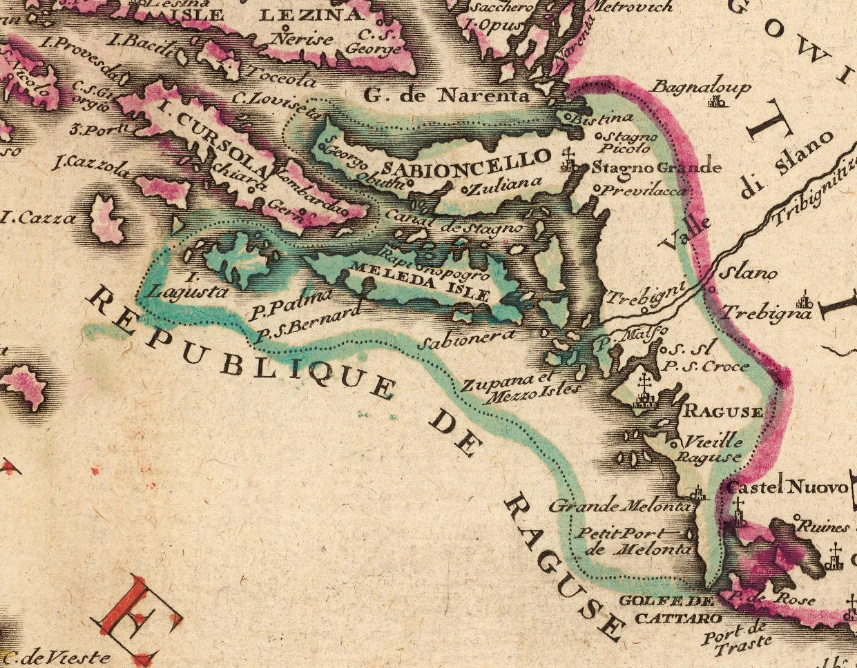
English: Territory of the Republic of Ragusa in the early 18th century. Cropped from a map by French cartographer Nicolas de Fer titled Le Golfe de Venise (etc.). Circa 1716. |
| Datum | early 18 century |
| Izvor | David Rumsey Historical Maps for sale |
| Autor | Nicolas de Fer, c. 1716 |
Licenciranje
|
Овај рад је такође у јавном власништву у државама са роком ауторства за живота аутора плус 100 година или мање. | |
| Utvrđeno je da ova datoteka nije ograničena u pogledu autorskih prava, uključujući i sva srodna i susedna prava. | |
Istorija datoteke
Kliknite na datum/vreme da biste videli tadašnju verziju datoteke.
| Datum/vreme | Minijatura | Dimenzije | Korisnik | Komentar | |
|---|---|---|---|---|---|
| trenutna | 16:02, 16. avgust 2015. | | 1.241 × 968 (2,56 MB) | Lubiesque | User created page with UploadWizard |
Upotreba datoteke
Sledeća stranica koristi ovu datoteku:
Globalna upotreba datoteke
Drugi vikiji koji koriste ovu datoteku:
- Upotreba na azb.wikipedia.org
- Upotreba na el.wikipedia.org
- Upotreba na en.wikipedia.org
- Upotreba na es.wikipedia.org
- Upotreba na ro.wikipedia.org