Датотека:USGS Rikers Island.png

Величина овог приказа: 732 × 599 пиксела. 6 других резолуција: 293 × 240 пиксела | 586 × 480 пиксела | 938 × 768 пиксела | 1.250 × 1.024 пиксела | 2.501 × 2.048 пиксела | 3.287 × 2.692 пиксела.
Оригинална датотека (3.287 × 2.692 пиксела, величина датотеке: 12,55 MB, MIME тип: image/png)
| Ово је датотека са Викимедијине оставе. Информације са њене странице са описом приказане су испод. Викимедијина остава је складиште слободно лиценциралних мултимедијалних датотека. И Ви можете да помогнете. |
Опис измене
| Опис | |
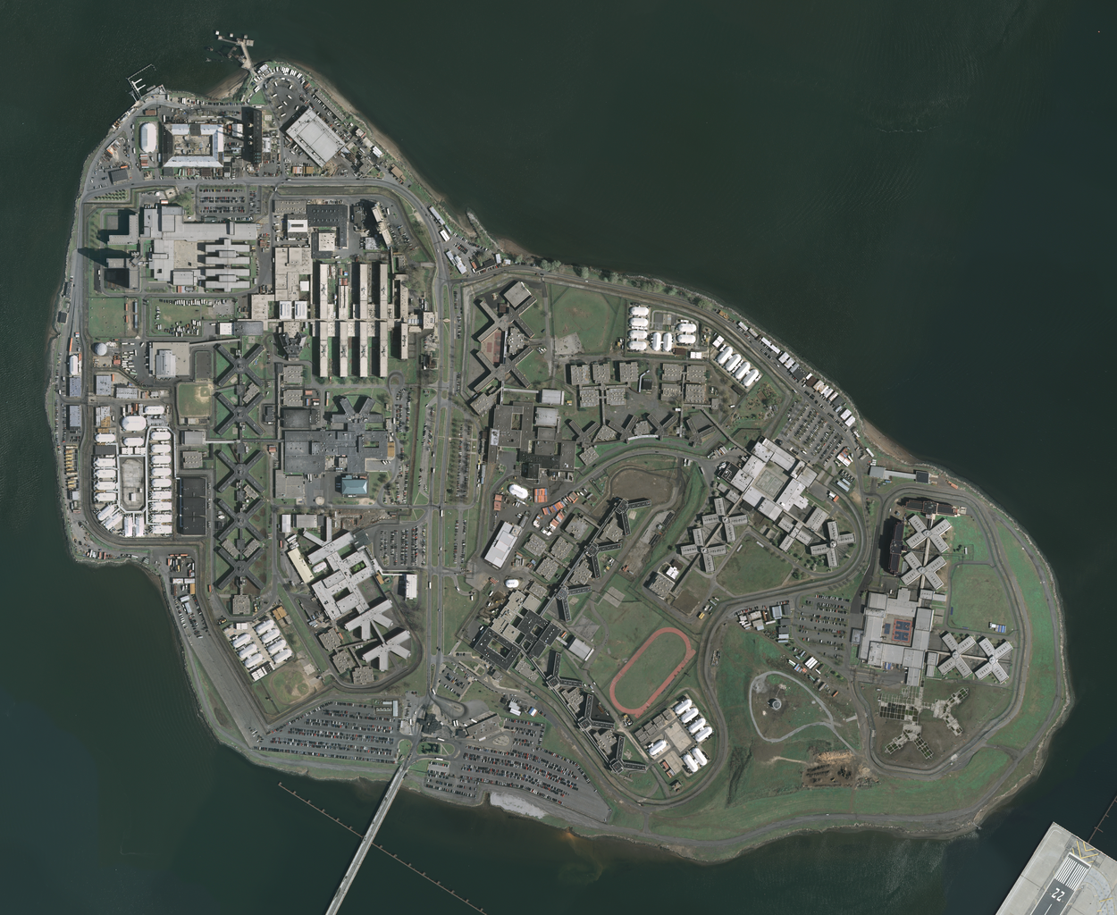
| Датум | Acquired in march 2006; published by USGS in 2008; converted and uploaded to Commons on April 22, 2009. |
| Извор |
The National Map Seamless Server, layer New York City (Mar 2006), latitude 40.79930093 to 40.78455349, longitude -73.89361276 to -73.86990631. Converted from GeoTIFF to PNG using GIMP. |
| Аутор | U.S. Geological Survey, conversion to PNG by uploader (Herr Satz). |
Лиценцирање
This image is in the public domain in the United States because it only contains materials that originally came from the United States Geological Survey, an agency of the United States Department of the Interior. For more information, see the official USGS copyright policy.
|
Историја датотеке
Кликните на датум/време да бисте видели тадашњу верзију датотеке.
| Датум/време | Минијатура | Димензије | Корисник | Коментар | |
|---|---|---|---|---|---|
| тренутна | 14:19, 22. април 2009. | | 3.287 × 2.692 (12,55 MB) | Herr Satz | {{Information |Description={{en|1=w:Orthophoto of w:Rikers Island.}} |Source=[http://gisdata.usgs.net/website/seamless/viewer.htm ''The National Map'' Seamless Server], layer [http://gisdata.usgs.gov/edc_catalog/fetch_layer_docs.php?LayerName=Ne |
Употреба датотеке
Следећа страница користи ову датотеку:
Глобална употреба датотеке
Други викији који користе ову датотеку:
- Употреба на ar.wikipedia.org
- Употреба на da.wikipedia.org
- Употреба на de.wikipedia.org
- Употреба на en.wikipedia.org
- Употреба на es.wikipedia.org
- Употреба на et.wikipedia.org
- Употреба на fr.wikipedia.org
- Употреба на hy.wikipedia.org
- Употреба на ja.wikipedia.org
- Употреба на ko.wikipedia.org
- Употреба на lt.wikipedia.org
- Употреба на nl.wikipedia.org
- Употреба на ru.wikipedia.org
- Употреба на uk.wikipedia.org