Датотека:Hvo controlled.png
Оригинална датотека (1.220 × 1.100 пиксела, величина датотеке: 99 kB, MIME тип: image/png)
| Ово је датотека са Викимедијине оставе. Информације са њене странице са описом приказане су испод. Викимедијина остава је складиште слободно лиценциралних мултимедијалних датотека. И Ви можете да помогнете. |
Опис измене
(
| Опис |
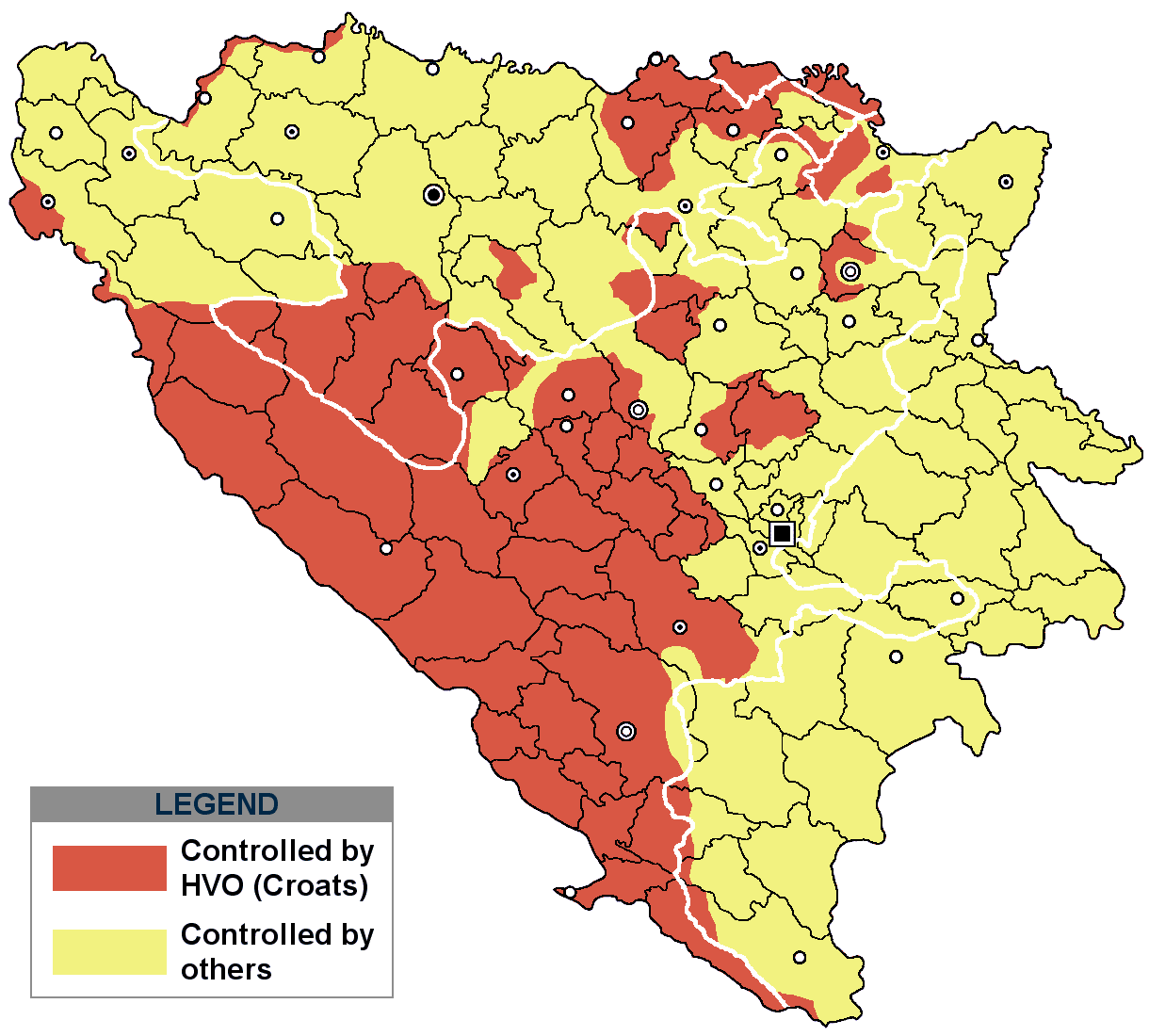
This is an update for the previous map, as the HVO never controlled all parts of municipality of Mostar and Stolac. Also, HVO never controlled neither part of municipalities Nevesinje, Berkovići, Ljubinje and Trebinje.
|
| Датум | |
| Извор | self-made by Nihad Hamzić |
| Аутор | Nihad Hamzic |
}
Лиценцирање
| Ово дело је њен носилац ауторских права I, Nihad Hamzic предао у јавно власништво. Ово се односи на цео свет. У неким земљама, ово није законски могуће; у том случају: I, Nihad Hamzic творац овог дела дозвољава свакоме да користи ово дело за било коју намену, без било каквих услова, осим услова које намеће закон. |
The original image is here:
http://commons.wikimedia.org/wiki/Image:Hvo_controled.GIF
Check its description for licensing etc.
Историја датотеке
Кликните на датум/време да бисте видели тадашњу верзију датотеке.
| Датум/време | Минијатура | Димензије | Корисник | Коментар | |
|---|---|---|---|---|---|
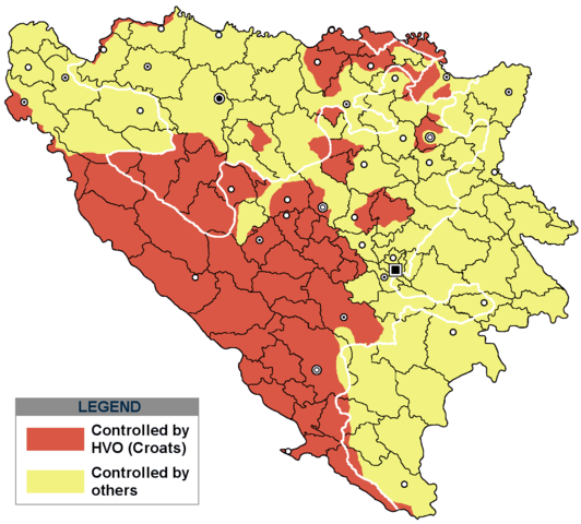
| тренутна | 19:21, 29. новембар 2020. | | 1.220 × 1.100 (99 kB) | Ceha | Tuzla i Bugojno |
| 15:31, 28. новембар 2020. |  | 1.220 × 1.100 (98 kB) | Ceha | Dodao neke promjene, od Ravne-Brčko, do Ravnog na jugu (operacija Bura https://hr.wikipedia.org/wiki/Operacija_Bura ) | |
| 19:40, 20. јул 2011. |  | 1.220 × 1.100 (48 kB) | DIREKTOR | Colors | |
| 11:29, 11. фебруар 2009. |  | 1.220 × 1.100 (49 kB) | Ceha | Corrected errors in Komušina municipality, HVO controled all of Croatian settlments till 10th of August 1991 | |
| 10:24, 11. август 2008. |  | 1.220 × 1.100 (49 kB) | Mostarac | {{Information |Description=This is an update for the previous map, as the HVO never controlled all parts of municipality of Mostar and Stolac. Also, HVO never controlled neither part of municipalities Nevesinje, Berkovići and Ljubinje. |Source=self-made | |
| 16:33, 5. јануар 2008. |  | 1.220 × 1.100 (49 kB) | Nihad Hamzic | Added a legend. Also widened the image slightly to match the size of related images. I did not resize it, but added white space at sides. | |
| 12:08, 17. јул 2007. |  | 1.213 × 1.100 (41 kB) | Nihad Hamzic | Revised the colors to match (to be uniform) with colors in other related maps. | |
| 00:31, 16. јул 2007. |  | 1.213 × 1.100 (41 kB) | Nihad Hamzic | {{Information |Description=BiH territories which were controlled by HVO and regular Croatian Army for some time during the war. <br /> <br /> NOTICE:<br /> This image is a greatly optimised PNG version of the original GIF version of the image. Color dihte |
Употреба датотеке
Следећа страница користи ову датотеку:
Глобална употреба датотеке
Други викији који користе ову датотеку:
- Употреба на ar.wikipedia.org
- Употреба на ast.wikipedia.org
- Употреба на bs.wikipedia.org
- Употреба на ca.wikipedia.org
- Употреба на cs.wikipedia.org
- Употреба на de.wikipedia.org
- Употреба на es.wikipedia.org
- Употреба на eu.wikipedia.org
- Употреба на fr.wikipedia.org
- Употреба на gl.wikipedia.org
- Употреба на hy.wikipedia.org
- Употреба на hyw.wikipedia.org
- Употреба на it.wikipedia.org
- Употреба на pnb.wikipedia.org
- Употреба на pt.wikipedia.org
- Употреба на ru.wikipedia.org
- Употреба на sv.wikipedia.org
- Употреба на vi.wikipedia.org