Датотека:Map of Cyrenaica.png

Veličina ovog prikaza: 800 × 543 piksela. 3 druge rezolucije: 320 × 217 piksela | 640 × 434 piksela | 918 × 623 piksela.
Originalna datoteka (918 × 623 piksela, veličina datoteke: 92 kB, MIME tip: image/png)
| Ovo je datoteka sa Vikimedijine ostave. Informacije sa njene stranice sa opisom prikazane su ispod. Vikimedijina ostava je skladište slobodno licenciralnih multimedijalnih datoteka. I Vi možete da pomognete. |
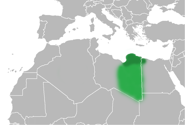
| Opis | The Ottoman Turks conquered the country in the mid-16th century, and the three States or "Wilayat" of Tripolitania, Cyrenaica and Fezzan (which make up Libya) remained part of their empire with the exception of the virtual autonomy of the Karamanlis. The Karamanlis ruled from 1711 until 1835 mainly in Tripolitania, but had influence in Cyrenaica and Fezzan as well by the mid 18th century. |
| Datum | (UTC) |
| Izvor | |
| Autor |
|
| Ostale verzije | File:Map of Cyrenaica.svg |
.png)
| Ово је ретуширана слика, што значи да је дигитално измењена у односу на своју изворну верзију. Измене: changes of area Cyrenaica. Изворна верзија се може видети овде: Ottoman Provinces Of Present day Libyapng.png. Измене је направио: Felitsata.
|
| Ja, tvorac ovog dela, predajem ga u javno vlasništvo. Ovo se odnosi na ceo svet. U nekim zemljama, ovo nije zakonski moguće; u tom slučaju: Ja, tvorac ovog dela dozvoljavam svakome da koristi ovo delo za bilo koju namenu, bez bilo kakvih uslova, osim uslova koje nameće zakon. |
Prvobitan dnevnik otpremanja
This image is a derivative work of the following images:
- File:United_States_of_North_Africa_Locator.png licensed with PD-self
- 2010-03-26T13:53:08Z Roxanna 1160x1056 (29795 Bytes) {{Information |Description={{en|1="United States of North Africa" (proposal by President [[en:Habib Bourguiba]] for Tunisia, Algeria and Libya 1973) and "Arab Islamic Republic" (proposal by [[en:Muammar al-Gaddafi]] for a uni
- File:Ottoman_Provinces_Of_Present_day_Libyapng.png licensed with PD-self
Uploaded with derivativeFX
Istorija datoteke
Kliknite na datum/vreme da biste videli tadašnju verziju datoteke.
| Datum/vreme | Minijatura | Dimenzije | Korisnik | Komentar | |
|---|---|---|---|---|---|
| trenutna | 22:51, 1. jul 2010. | | 918 × 623 (92 kB) | Felitsata | change of border |
| 22:33, 1. jul 2010. |  | 918 × 623 (93 kB) | Felitsata | {{Information |Description={{en|1="United States of North Africa" (proposal by President [http://en.wikipedia.org/wiki/Habib_Bourguiba Habib Bourguiba] for Tunisia, Algeria and Libya 1973) and "Arab Islamic Republic" (proposal by [http://en.wikipedia.org/ |
Upotreba datoteke
Globalna upotreba datoteke
Drugi vikiji koji koriste ovu datoteku:
- Upotreba na bg.wikipedia.org
- Upotreba na bn.wikipedia.org
- Upotreba na en.wikipedia.org
- Upotreba na es.wikipedia.org
- Upotreba na fa.wikipedia.org
- Upotreba na fi.wikipedia.org
- Upotreba na he.wikipedia.org
- Upotreba na hr.wikipedia.org
- Upotreba na hy.wikipedia.org
- Upotreba na inh.wikipedia.org
- Upotreba na it.wikipedia.org
- Upotreba na ja.wikipedia.org
- Upotreba na ko.wikipedia.org
- Upotreba na la.wiktionary.org
- Upotreba na nn.wikipedia.org
- Upotreba na pl.wiktionary.org
- Upotreba na ro.wikipedia.org
- Upotreba na ru.wikipedia.org
- Upotreba na sh.wikipedia.org
- Upotreba na sl.wikipedia.org
- Upotreba na th.wikipedia.org
- Upotreba na tr.wikipedia.org
- Upotreba na uk.wikipedia.org