Датотека:Relief Map of Germany.svg

Originalna datoteka (SVG datoteka, nominalno 1.073 × 1.272 piksela, veličina: 6,54 MB)
| Ovo je datoteka sa Vikimedijine ostave. Informacije sa njene stranice sa opisom prikazane su ispod. Vikimedijina ostava je skladište slobodno licenciralnih multimedijalnih datoteka. I Vi možete da pomognete. |
Opis izmene
| Opis |
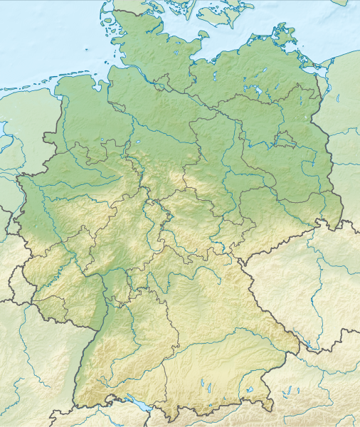
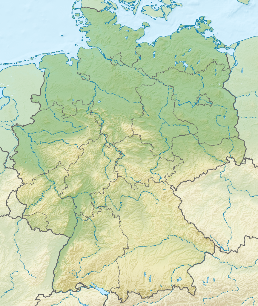
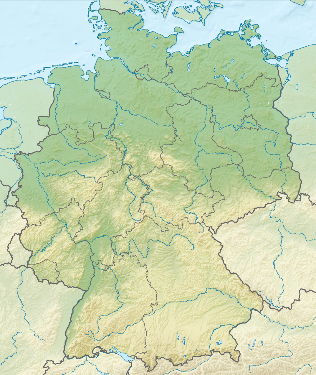
Deutsch: Positionskarte von Deutschland mit Gewässern
Quadratische Plattkarte, N-S-Streckung 150 %. Geographische Begrenzung der Karte:
English: Location map of Germany with waterbodies
Equirectangular projection, N/S stretching 150 %. Geographic limits of the map:
|
| Datum | |
| Izvor |
Sopstveno delo This vector image includes elements that have been taken or adapted from this file: This vector image includes elements that have been taken or adapted from this file: |
| Autor |
TUBS |
| Ostale verzije |
Bundesrepublik Deutschland (vor 1990 nur West-Deutschland):
Deutsche Demokratische Republik (mit BRD im Ausschnitt):
Ostdeutschland (vor 1990 Deutsche Demokratische Republik):
Deutschland zwischen Mai 1945 und Oktober 1949:
Thematisch:
Deutsches Reich (1918–1945) (best used with this template (de)):
|
| SVG genesis |


_23_May_1949_-_6_Oct_1949.svg)


_location_map.svg)
_location_map_2013.svg)


Licenciranje
- Dozvoljeno je:
- da delite – da umnožavate, raspodeljujete i prenosite delo
- da prerađujete – da preradite delo
- Pod sledećim uslovima:
- autorstvo – Morate da date odgovarajuće zasluge, obezbedite vezu ka licenci i naznačite da li su izmene napravljene. Možete to uraditi na bilo koji razuman manir, ali ne na način koji predlaže da licencator odobrava vas ili vaše korišćenje.
- deliti pod istim uslovima – Ako izmenite, preobrazite ili dogradite ovaj materijal, morate podeliti svoje doprinose pod istom ili kompatibilnom licencom kao original.

|
I'd greatly appreciate, that you attribute this media file to Wikimedia Commons, if used outside Wikipedia or Commons. For use in publications such as books, newspapers, blogs, websites, please insert here the following line:
|
Istorija datoteke
Kliknite na datum/vreme da biste videli tadašnju verziju datoteke.
| Datum/vreme | Minijatura | Dimenzije | Korisnik | Komentar | |
|---|---|---|---|---|---|
| trenutna | 16:00, 1. decembar 2011. | | 1.073 × 1.272 (6,54 MB) | TUBS |
Upotreba datoteke
22 sledeće stranice koriste ovu datoteku:
- Lajpcig
- Језеро Мириц
- Амерско језеро
- Ајфел
- Боденско језеро
- Велико плонско језеро
- Географија Немачке
- Кимско језеро
- Кумеровско језеро
- Лахско језеро
- Национални парк Ваденско море (Шлезвиг-Холштајн)
- Оденвалд
- Плаувско језеро
- Рудне горе
- Харц
- Хелголандски залив
- Цугшпице
- Шварцвалд
- Шверинско језеро
- Штарнбершко језеро
- Штајнхудско језеро
- Шаблон:Location map Germany
Globalna upotreba datoteke
Drugi vikiji koji koriste ovu datoteku:
- Upotreba na an.wikipedia.org
- Upotreba na ar.wikipedia.org
- Upotreba na ast.wikipedia.org
- Upotreba na az.wikipedia.org
- Upotreba na ban.wikipedia.org
- Taman Nasional Swiss Saxon
- Taman Nasional Hunsrück-Hochwald
- Taman Nasional Eifel
- Taman Nasional Hainich
- Taman Nasional Kellerwald-Edersee
- Taman Nasional Harz
- Taman Nasional Lebah Oder Sor
- Taman Nasional Müritz
- Taman Nasional Wawengkon Laguna Pomerania Kawan
- Taman Nasional Jasmund
- Taman Nasional Segara Wadden Saxon Sor
- Danu Laacher
- Upotreba na ba.wikipedia.org
- Upotreba na be.wikipedia.org
Još globalnog korišćenja ove datoteke.